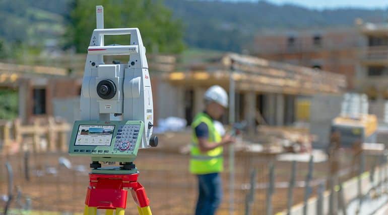
The Leica TS16 Total Station
What is a Total Station?
A Total Station is a modern surveying instrument that integrates an electronic theodolite with an electronic distance meter.
A theodolite uses a movable telescope to measure angles in both the horizontal and vertical planes. Traditionally they are manual instruments that come in two types – transit, which rotates in a full circle in the vertical plane, and non-transit, rotating in a half-circle.
Total Stations use electronic transit theodolites in conjunction with a distance meter to read any slope distance from the instrument to any particular spot. They are hence two essential surveying instruments in one and when used with other technology such as mapping software are able to deliver the ‘total’ surveying package, from measuring to mapping.
How Have They Changed Surveying?
The development of Total Stations has markedly increased productivity in the surveying profession in the following ways.
Improved Accuracy
First of all, improved accuracy: while co-ordinate measurements by the theodolite are done in the traditional way – trigonometry and triangulation – the angles are measured by means of electro-optical scanning to a high degree of accuracy – up to 0.5 arc-seconds. What’s more, a drawback of traditional theodolites is they require a line-of-sight between two points; now GPS technology can be used by a Total Station to include unseen points in the survey.
Efficiency & Functionality
Other increases in productivity are due to efficiency and functionality. One advantage is that many Total Stations, such as the Leica Viva TS15 used by Jurovich Surveying, are robotic. This means they can be operated at a distance, hence requiring only one surveyor in the field, rather than the traditional two. For example, the robotic controller can stream the Total Station’s view to a surveyor at a remote point, who can make measurements and change the target area without returning to the Total Station.
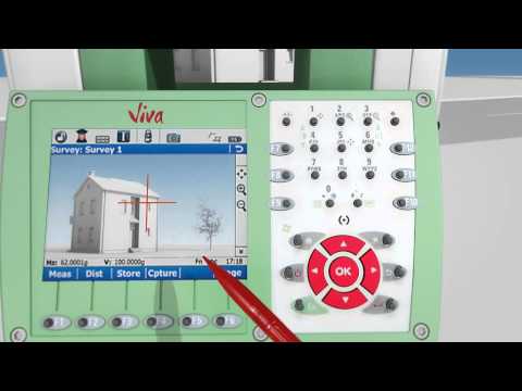
Image Capture Technology
Total Stations also include up-to-date image capture technology, which can record any image or screen-view from the surveying site, eliminating the need for costly revisits, and producing high-resolution images of site conditions.
Documentation & Sketching
And did you know that a traditional problem for surveyors is simply wet paper? A Total Station has electronic documentation and sketching functions, which reduces the need for paper field notes.
Data Storage & Sharing
Finally, the data processed and stored in the Total Station can be downloaded to other computer systems, for archiving or distribution, or to be used with other applications such as mapping software.
In the 21st century, Total Stations have replaced the manual theodolite as the surveyor’s essential field tool.
Leica Robotic TS15 Total Station
We hope you find the information useful.
Back to FAQBack to FAQ