1977 saw the creation of the world’s first complete map of the ocean floor, completed by two oceanographers from Columbia University named Marie Tharp and Bruce Heezen. Their map helped show what nobody had ever seen before, what it actually looked like at the bottom of the sea.
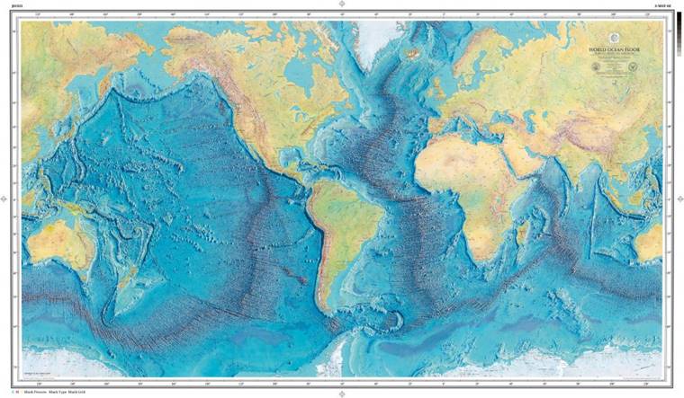 Image Source: Marie Tharp Maps
Early As 1952
Mountains, caverns and how the sea floor curved around continents were documented earlier by Tharp and Heezen from 1952 when they first began mapping the ocean floor. Tharp also discovered that in fact continental drift was no longer fictional, but that it was actually happening at the rate of millimetres per day. This was a very important discovery.
Accurate Against All Odds
Tharp, who drew the maps, first started with creating individual maps of each of the oceans and then put them all into one map. Working with limited data obtained by sonar readings from ships, Tharp had to use her training and knowledge to put together an approximate map which has since been proven largely correct.
Jurovich Surveying
An incredible story of curiosity and tenacity!
We aren’t in the business of surveying the ocean but are very active ‘on land’ in Perth and regional Western Australia. Jurovich Surveying. Please contact us.
Read more about this story on the Intelligent Life magazine.
Back to newsBack to news